 Catch Pins
About Catch Pins
Keep the fish, the place and the conditions together, so a great day on the water becomes something you can look back on and learn from.
Your fishing memories, easy to find
A good catch deserves more than getting lost between everyday photos. Catch Pins gives your fish their own visual collection, with the weight, length, lure, location and conditions beside each catch.
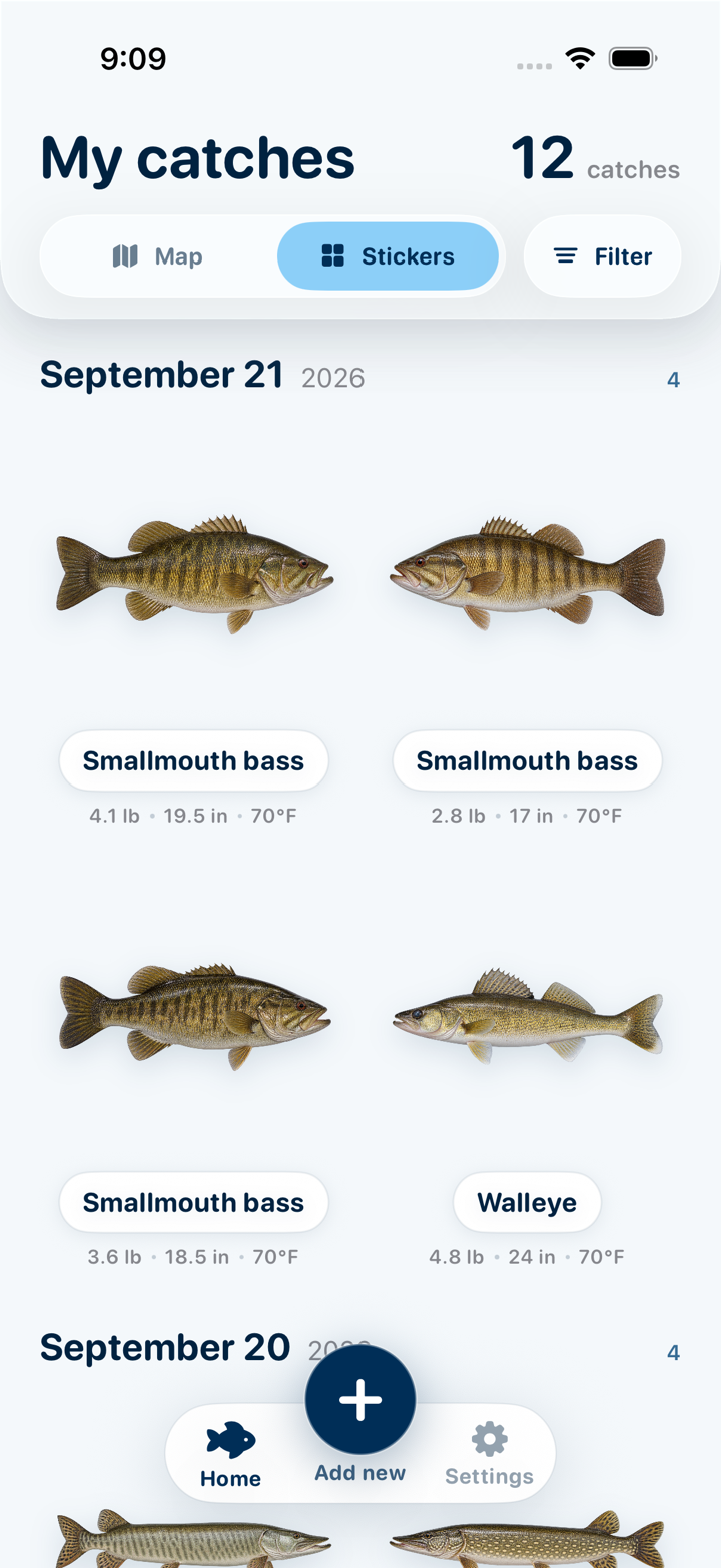
Start with a photo you're already taking. The app turns the fish into a sticker and suggests a species, then you add the details you want to remember. Every measurement is optional, so you can keep logging simple or build a detailed record over time.
Looking for your biggest bass or the longest fish from a trip? Filter by weight and length, sort by heaviest or longest, or filter by species. Your best catches are ready to revisit without hunting through your camera roll.
Species suggestions are best-effort and can be wrong. You can always edit the name, and it's worth confirming with a trusted field guide when accuracy matters — for regulations, size limits, or anything you plan to eat.
Build a map of places worth returning to
Save the spot with the fish
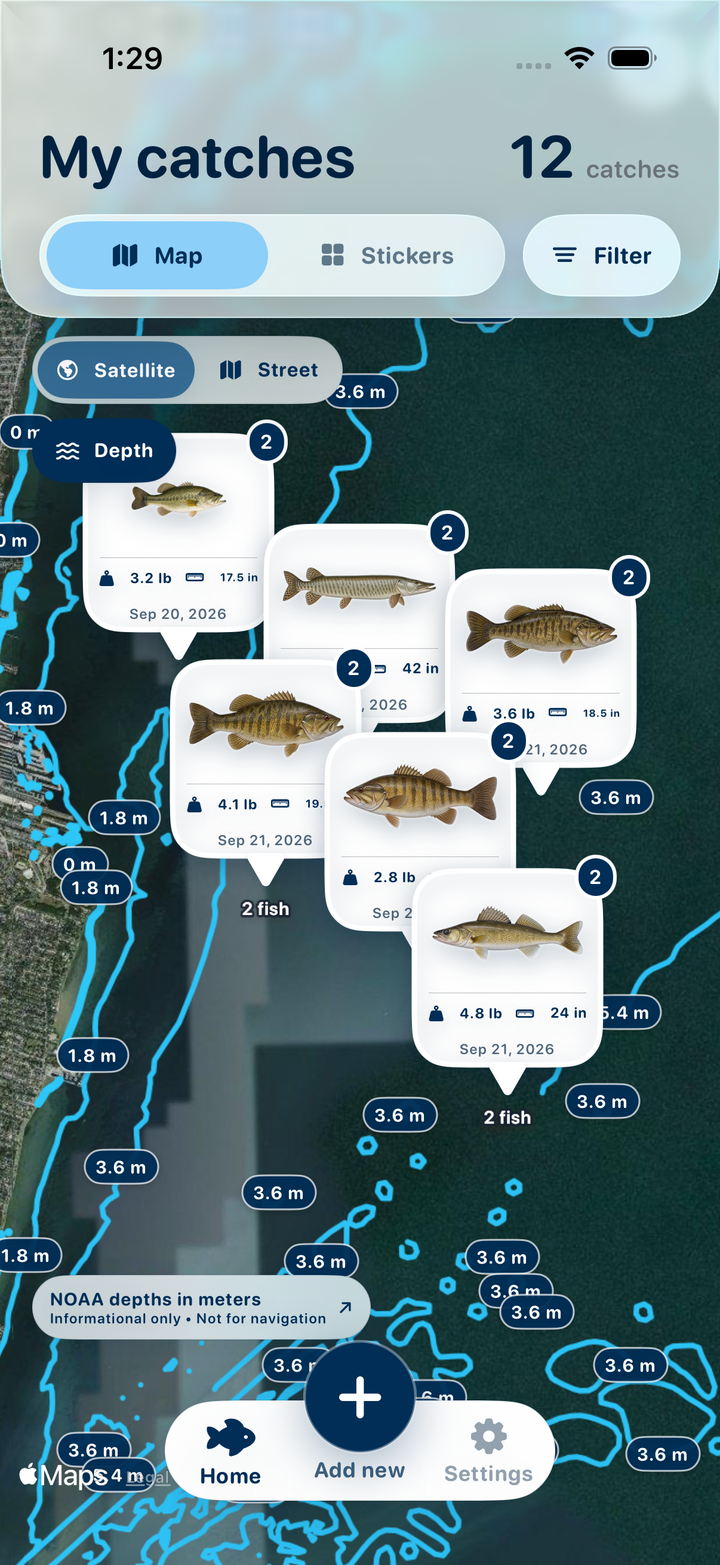
A catch location keeps the memory tied to the water where it happened. Open the map to see your saved spots and the fish you caught there, then tap into the catch details when you want a closer look.
Revisit favorites when conditions line up
Filter past catches by month, a seasonal date range, or water and air temperature. Combine those with species, weight or length to see where the fish you're looking for showed up before. Use your own history to decide which spot to try again.
Take your fishing history on the road
Traveling back to a lake or exploring a familiar region? See the fishing locations you've saved across your trips and the catches from each place at a glance. Your map becomes a record of the waters you've explored, from nearby favorites to trips farther afield.
What stays put, and what leaves
Catch Pins is close to a fully offline app, but not quite one — and it's worth being precise about the difference.
Stored and processed on your device
- The original fish photo and its transparent cutout
- The optional lure or bait photo and cutout
- The fish name you keep or type
- Weight, length, water temperature, lure, spot, released flag
- The precise catch coordinate stored with the catch
- Every species-identification and cutout computation
You can export a backup through Files and choose where to store it, including a cloud provider. The developer does not receive your backup.
Sent to Open-Meteo, for weather only
- A catch coordinate rounded to two decimal places
- The catch date and hour
Weather requests contain no photo, fish name, catch details, account, advertising or device identifier. With no catch location, no weather request is made. Your saved gallery remains available offline.
Maps use Apple Maps. When you turn on Depth, the visible map area is sent to NOAA to load chart contours. Fish photos and catch details are not sent with these map requests.
Open-source acknowledgements
Catch Pins is built on some excellent open work. The machine-learning pieces all run on your device.
BioCLIP 2
MIT-licensed ViT-L/14 vision encoder used for species identification, matched against a fish-only subset of the TreeOfLife-200M text embeddings.
Imageomics/bioclip-2Fishial.AI
MIT-licensed FPN/ResNet18 segmentation model, used solely as a cutout fallback when Apple Vision can't isolate a fish. It never supplies a fish name.
fishial/fish-identificationONNX Runtime
Microsoft's MIT-licensed inference engine, which runs the identification model locally on your device.
microsoft/onnxruntimeOpen-Meteo
Public weather and marine APIs supplying historical catch conditions, no key required. Weather data is used under the Creative Commons Attribution 4.0 license.
open-meteo.comFull license texts are available in the app, from Settings → Privacy & acknowledgements.